APIs
Application Programming Interfaces (APIs) provided by VEDA
Most of the VEDA APIs are hosted out of a single project (veda-backend) that combines multiple standalone services.
Environments
While some of our services are already very mature, VEDA is currently in the build-up phase. Therefore, we do not yet have a production environment for users. Maintenance on the staging environment will be announced internally and selected known stakeholders will be informed of any larger changes.
Production (stable): Coming soon
Staging (maintenance will be announced):
- STAC browser: veda-staging-stac-browser
- STAC API (metadata): staging-stac.delta-backend.com/docs
- List collections: staging-stac.delta-backend.com/collections
- Raster API (map tiles and timeseries): staging-raster.delta-backend.com/docs
- Features API (vector data): firenrt.delta-backend.com - see also the usage tutorial
- STAC viewer (experimental): staging-stac.delta-backend.com
Development, aka Dev (experimental work, expected downtime)
- STAC browser: veda-dev-stac-browser
- STAC API (metadata): dev.openveda.cloud/api/stac/docs
- List collections: dev.openveda.cloud/api/stac/collections
- Raster API (map tiles and timeseries): dev.openveda.cloud/api/raster/docs
- STAC viewer (experimental): dev.openveda.cloud/api/stac/index.html
Using tile layers in external services
UI for single tile layers
As you can see from our API docs referenced above, our raster API provides WMTS and XYZ tiles for public consumption.
For any layer you are seeing in the VEDA dataset Explorer, you can retrieve the tile URL:
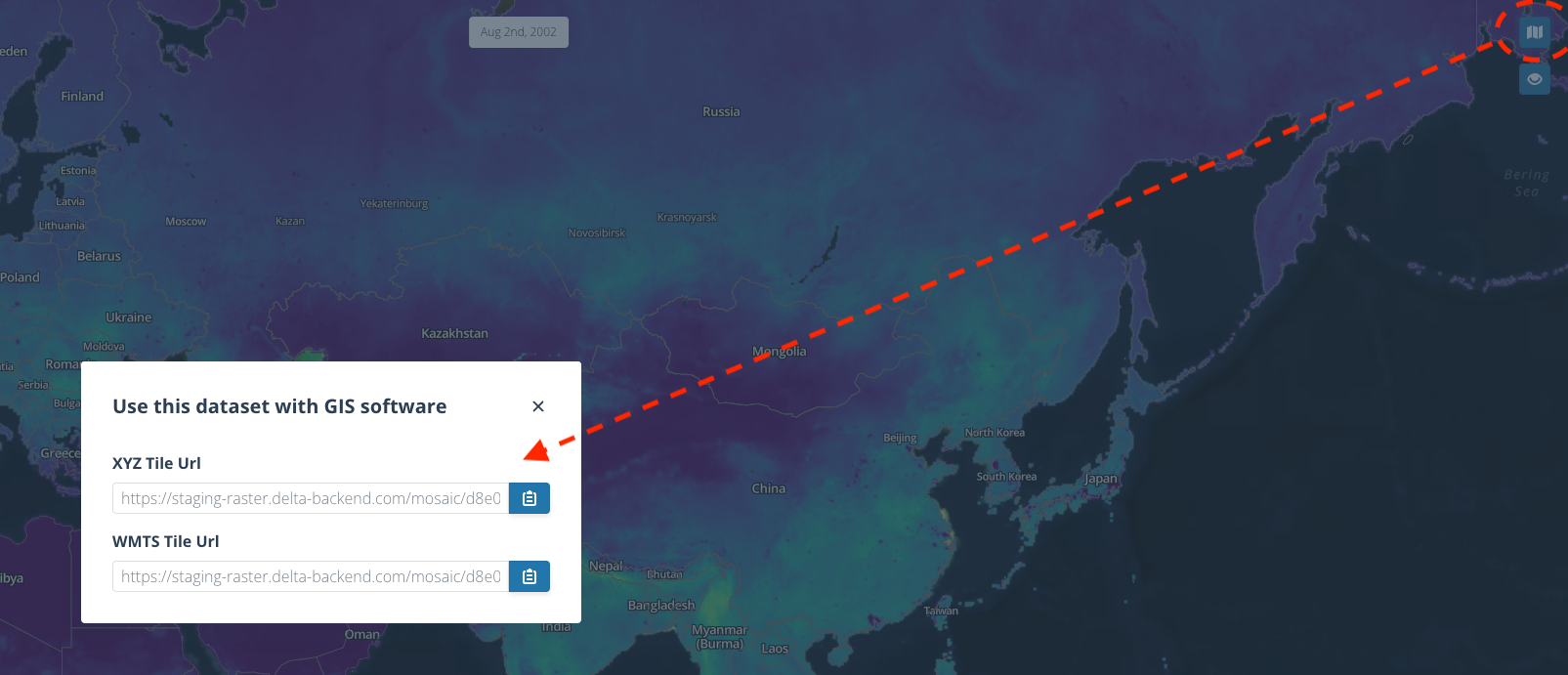
And paste that into any client that loads these tiles, like QGIS, ArcGIS, Leaflet, even online tools such as geojson.io or felt.com.
STAC for layer timeseries
If you want to integrate tile layer time series into your application, you will need to fetch the information about which time steps exist and what the layer URLs are from our Spatio Tempoeral Asset Catalog (STAC) API (see above).
That is because, unfortunately, neither XYZ nor WMTS have time series capabilities (unlike good old WMS, which our services do not provide, though).
You can see how to retrieve time steps and tile layer URLs from these tutorial Python notebooks (mostly REST API calls):
- Using /stac/tilejson.json with STAC collection and item IDs
- Creating layers from filters and mosaics (advanced)
It comes down to querying for STAC items (timesteps) and then asking the Raster API for tilejson.json specifications for the items you are interested in.
Once you retrieved the WMTS or XYZ layer URLs this way, you can use them seamlessly with all mapping clients.